
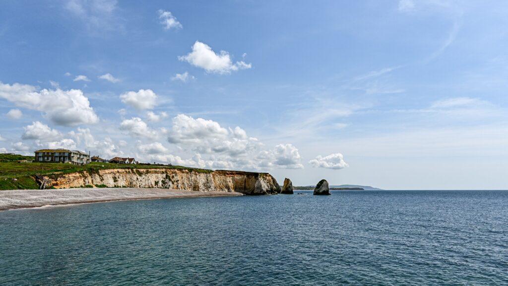
The Best Viewpoints on the Isle of Wight
The Isle of Wight has an extraordinary variety of views for such a compact place. Chalk cliffs rise above blue water, wooded slopes fall towards Victorian towns, and high downs reveal farmland stretching across the Island. Some viewpoints are close to a road or car park, while others feel earned after a steady climb.
Conditions matter as much as location. A clear morning can reveal the mainland across the Solent, while evening light brings warmth to the western cliffs. Take sensible footwear, stay back from cliff edges and allow time to enjoy the view rather than simply collecting photographs.
Tennyson Down and the Needles
Tennyson Down is the classic Isle of Wight viewpoint. The broad chalk ridge rises above Freshwater and leads west towards the Needles headland. From the higher ground, the sea opens on both sides and the Island’s western coastline stretches into the distance.
The Tennyson Monument is a natural destination, but continuing towards the Needles gives the landscape an even more dramatic character. The route crosses exposed downland with little shelter, so wind and weather can make it demanding. Several walk lengths are possible. Begin near Freshwater Bay for a longer ridge walk, or use facilities closer to the Needles for shorter options.
The Needles Old Battery
The Old Battery provides a distinctive view of the Needles and lighthouse from above. Built in the nineteenth century to protect the coast, the fort now combines military history with one of the Island’s most recognisable panoramas. A tunnel through the chalk leads to a searchlight position with a striking angle over the sea stacks.
Entry arrangements and opening times apply, so check before travelling. The headland can be busy in summer, but walking away from the main visitor area often creates a quieter experience.
Culver Down
At the eastern end of the Island, Culver Down looks across Sandown Bay, Bembridge and the Solent. The tall Yarborough Monument makes the ridge easy to recognise. A road reaches the upper area, which makes this one of the more accessible high viewpoints, although surfaces and exact access should still be checked by anyone with limited mobility.
The open grassland is excellent for a walk, with military remains and chalk wildlife adding interest. On a clear day, you can trace a long section of the eastern coast. Keep dogs under close control because of livestock, wildlife and the nearby cliffs.
Ventnor Downs
Ventnor Downs rise steeply behind the town and create a wonderful contrast between rugged hillside and the buildings below. Views extend over Ventnor, the Undercliff and the English Channel. The highest roads and car parks reduce the amount of climbing, but the walking routes can still be steep and uneven.
This is a particularly atmospheric place when light moves across the sea. The downs also contain evidence of prehistoric and wartime activity, so a walk can combine scenery with local history. Mist sometimes gathers on the high ground even when the coast looks clear, making a weather check worthwhile.
St Boniface Down
St Boniface Down is the Island’s highest point, reaching 241 metres above sea level. It sits above Ventnor and offers wide views when conditions are clear. The height brings stronger wind and rapidly changing weather, and some approaches are steep.
Walkers who want a quieter viewpoint than the Needles may find it especially rewarding. Look beyond the town and coast to appreciate the folds of the surrounding downland. In late summer, heathland colour can add another layer to the scene.
St Catherine’s Down
The long ridge of St Catherine’s Down has panoramic views across the south of the Island. The Hoy Monument stands prominently on the high ground, while the surrounding landscape carries stories of shipwrecks, communication experiments and rural life.
Routes vary from short climbs to longer circular walks. The terrain can become muddy, and exposed sections require care in strong wind. From the ridge, the southern coastline feels wilder and less developed than the resort towns to the east.
Compton Bay and Downs
Compton Bay is best known for its beach, cliffs and sunsets. From the downs above, the view follows a sweep of coast towards Freshwater and the western headlands. The Military Road provides several opportunities to stop nearby, but use proper car parks and never obstruct the road or gateways.
Low evening sun can be spectacular, especially when it catches the cliffs. Check sunset time and leave enough daylight to return safely. Cliffs along this coast are unstable, so remain behind barriers and avoid standing beneath them on the beach.
Brading Down
Brading Down offers broad views over the eastern side of the Island, including farmland, villages and the coast around Sandown Bay. Road access makes it a useful stop for visitors who want a rewarding outlook without a long hike. Picnic areas add to its appeal on a calm day.
The view is different from the drama of the Needles. It helps you understand the shape of the Island and the relationship between its downs, settlements and coast. Morning light often suits the east-facing landscape.
Carisbrooke Castle keep
For a viewpoint with a historic setting, climb the Norman keep at Carisbrooke Castle. The elevated position explains why the site was so important for defence. You can see across the centre of the Island while standing within a place shaped by more than a thousand years of history.
Access involves steep, uneven steps and is not suitable for everyone. The castle grounds still offer attractive views if you choose not to climb. Admission and seasonal opening arrangements apply.
Make every viewpoint safer and more memorable
Wear shoes with grip, carry a layer even on a bright day and keep well away from cliff edges. Chalk can be slippery when wet, and coastal erosion means an apparently solid edge may be undercut. Drones must be used only where permission and aviation rules allow.
For photography, early and late light generally provides more depth than midday sun. For simple enjoyment, put the camera away for a few minutes. Listen to the wind, watch the ferries crossing the Solent and let the scale of the Island settle into view. The best viewpoint is not always the highest. It is the one where you stop long enough to notice what surrounds you.
Plan your journey
Before travelling, check current ferry times, routes and booking options directly with Wightlink. Booking ahead is particularly sensible during weekends, school holidays and major Island events.