
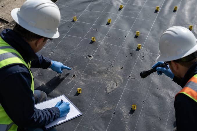
Geomembrane CQA Survey Standards: What Engineers Need to Specify in Project Documents
Construction quality assurance (CQA) is the backbone of every successful geomembrane installation, and survey work sits at the center of that assurance. Whether the project is a landfill liner, a mining heap leach pad, or a wastewater lagoon, the geometric accuracy of the subgrade, the liner panels, and the final cover system determines whether the engineered system performs as designed. Yet survey requirements are often treated as an afterthought in project specifications, left vague or borrowed from unrelated civil projects. This gap creates real risk: inadequate slope verification, undetected wrinkles or bridging, and drainage systems that do not perform because grades were never properly confirmed.
Engineers who specify geomembrane CQA survey services with precision protect the owner’s investment, reduce the likelihood of costly field disputes, and give the CQA team a clear, enforceable standard to work against. This article walks through what belongs in a well-written survey specification, the standards that inform it, and the common pitfalls that lead to ambiguity and rework.
Why Survey Specifications Deserve Dedicated Attention
Many specifications fold survey requirements into general earthwork or geosynthetics sections, with a single sentence noting that “as-built surveys shall be performed.” This approach leaves too much to interpretation. Without a dedicated survey specification, questions arise mid-project: What coordinate system should be used? What is the acceptable vertical tolerance on subgrade? How often should topographic checks occur during liner placement? Who certifies the final as-built survey, and in what format is it delivered?
A dedicated survey specification answers these questions before mobilization, not during it. It establishes a single source of truth that the owner, the engineer of record, the CQA consultant, and the installation contractor can all reference. This matters because geomembrane systems are unforgiving of geometric error. A subgrade that is a few inches out of tolerance can create ponding on a landfill cap, stress concentrations at pipe penetrations, or inadequate freeboard in a lined pond. Surveys are the mechanism by which these risks are caught before they become permanent features of a buried system.
Core Elements of a Geomembrane Survey Specification
A complete survey specification for a geomembrane project should address several distinct phases, each with its own accuracy requirements and deliverables.
Pre-Construction Topographic Survey
Before any earthwork begins, a baseline topographic survey establishes existing conditions. This survey should capture the existing ground surface at a density sufficient to support accurate cut and fill calculations, and it should tie into the same horizontal and vertical datum that will be used throughout the project. Engineers should specify the point spacing or grid density required, particularly in areas with complex topography such as benches, anchor trenches, or sump locations.
Subgrade Verification Survey
Once the subgrade is prepared and before the geomembrane is deployed, a verification survey confirms that the prepared surface meets the design grades within the specified tolerance. This is one of the most consequential surveys on the project, because once the liner is placed, the subgrade is effectively hidden. Specifications should state the minimum grid spacing for data collection (commonly on a defined interval such as every 50 or 100 feet, tightened in critical areas like sumps, pipe penetrations, and anchor trenches), the vertical tolerance allowed above and below design grade, and the requirement that low spots, ponding areas, and sharp grade breaks be flagged and corrected before deployment proceeds.
Panel Layout and Deployment Survey
During deployment, survey control helps installation crews place panels according to the approved layout drawing, particularly on complex geometries involving pipe boots, sumps, or non-rectangular cells. The specification should require that key control points (toe of slope, top of slope, anchor trench centerline, penetration locations) be staked or otherwise marked by survey before liner placement begins.
As-Built Survey
Upon completion, an as-built survey documents the final, installed condition of the geomembrane system. This should include the final geomembrane surface elevations, panel seam layout where feasible, location and elevation of all penetrations and appurtenances, and the as-built anchor trench alignment. The specification should state clearly what format the as-built data must be delivered in (CAD drawing, GIS shapefile, point cloud, or a combination), what datum and coordinate system apply, and what certifications or professional stamps are required on the final deliverable.
Specifying Horizontal and Vertical Accuracy
One of the most important, and most frequently underspecified, elements of a survey specification is the required level of accuracy. Vague language such as “survey to reasonable accuracy” gives the surveyor and the CQA team nothing enforceable to work against.
Instead, the specification should state explicit numerical tolerances. For example, subgrade surveys are commonly specified to a vertical accuracy of plus or minus 0.1 feet (or a metric equivalent), while horizontal control for key features like anchor trenches and penetrations may require tighter tolerances given their importance to system performance. The specification should distinguish between the accuracy of the survey instrument and method itself (an RTK GNSS survey, a total station traverse, or a UAV-based photogrammetric survey each carry different inherent accuracies) and the acceptable as-built tolerance of the constructed feature relative to design.
It is also worth specifying the required accuracy class for benchmarks and control points, since every subsequent survey on the project depends on the integrity of that initial control network. A poorly established benchmark propagates error through the entire project record.
Coordinate Systems, Datums, and Data Formats
Geomembrane projects frequently span large sites, and in some cases multiple contractors or survey crews work on the same project over months or years. Without a specified coordinate system and vertical datum, data from different phases of the project can become incompatible, leading to confusing or contradictory as-built records.
The specification should name the exact horizontal coordinate system (state plane zone, UTM zone, or a project-specific local grid) and the vertical datum (such as NAVD88) to be used for all survey work on the project. It should also specify the required file formats for deliverables, commonly including AutoCAD DWG, LandXML, ESRI shapefile, or a project-specific GIS geodatabase, along with any required metadata such as point codes, descriptions, and timestamps. Specifying these details up front avoids the common and costly situation where survey data must be reprocessed or re-registered late in the project because it was collected in an incompatible system.
Survey Technology and Methods
Engineers do not need to dictate a single survey technology, but the specification should identify which methods are acceptable and under what conditions. RTK GNSS survey is well suited to open areas with clear sky visibility and is commonly used for subgrade and as-built surveys on large sites. Total station surveys remain valuable in areas with obstructions, steep slopes, or where higher point density and precision are needed, such as around penetrations and sumps. UAV-based photogrammetry and LiDAR have become increasingly common for generating dense surface models across large liner areas quickly, though the specification should require that any UAV-derived surface be checked against a minimum number of ground control points surveyed by conventional methods, to confirm accuracy before the data is accepted.
Whatever methods are allowed, the specification should require that survey equipment be calibrated according to manufacturer requirements, and that calibration records be available for review by the CQA engineer upon request.
Frequency and Timing of Surveys
A specification should be explicit about when surveys occur relative to construction activities, not just what accuracy is required. Subgrade surveys should be required after final grading and before geomembrane deployment, with a defined maximum time gap between survey and liner placement to avoid conditions changing (due to weather, traffic, or erosion) between verification and installation. Surveys during deployment should be tied to specific milestones, such as completion of each phase or cell, rather than left to the discretion of the installer.
Specifying the sequence this way prevents a common field problem: liner placed over subgrade that was surveyed weeks earlier and has since been disturbed by equipment traffic or rainfall.
Documentation, Reporting, and QA Review
Survey data is only useful if it is captured, reported, and reviewed in a way that the CQA team can act on quickly. The specification should require that survey results be submitted in a standard reporting format that clearly identifies areas out of tolerance, with corresponding grid coordinates and elevations, rather than a raw data dump that requires significant interpretation.
It is good practice to require that any out-of-tolerance condition identified during subgrade or as-built survey be reported to the CQA engineer within a specified number of hours, so that corrective action can be scheduled without delaying the broader construction schedule. The specification should also define who has authority to accept or reject survey results, typically the CQA engineer or engineer of record, and what documentation is required to close out a nonconformance once corrective grading has occurred.
Integrating Survey Requirements with the CQA Plan
A survey specification should not exist in isolation. It needs to be cross-referenced in the project’s CQA plan so that survey milestones align with other quality control activities such as geomembrane seam testing, liner inspection, and material conformance testing. For example, the CQA plan might specify that subgrade survey approval is a prerequisite for liner deployment to begin, just as proof rolling or density testing might be a prerequisite elsewhere in earthwork specifications.
This integration ensures that survey data becomes part of the enforceable sequence of construction, not simply a record-keeping exercise completed after the fact. It also clarifies responsibility: the specification should state whether the owner, the CQA firm, or the installation contractor is responsible for procuring geomembrane CQA survey services, and how survey costs and scheduling are coordinated among the parties.
Common Specification Gaps to Avoid
Several recurring issues show up in poorly written survey specifications. The first is failing to specify tolerance values numerically, leaving “acceptable grade” open to interpretation. The second is omitting a defined coordinate system and datum, which causes data incompatibility across project phases. The third is not requiring ground control checks for UAV or photogrammetric surveys, which can produce a visually convincing but inaccurate surface model. The fourth is leaving the as-built deliverable format unspecified, which often results in data that cannot be easily integrated into the owner’s long-term facility records or GIS systems. Addressing these gaps during the specification writing stage, rather than during construction, saves time, reduces disputes, and results in a more defensible project record.
Frequently Asked Questions
What is the difference between a subgrade survey and an as-built survey?
A subgrade survey verifies the prepared ground surface before the geomembrane is installed, confirming it meets design grade and tolerance. An as-built survey documents the final, completed condition of the installed liner system, including elevations, penetrations, and anchor trench alignment.
How accurate does a geomembrane subgrade survey need to be?
Accuracy requirements vary by project, but common vertical tolerances fall within a few tenths of a foot (or several centimeters). The exact tolerance should always be stated numerically in the survey specification rather than left general.
What survey methods are typically used on geomembrane projects?
Common methods include:
- RTK GNSS survey for open, large-area sites
- Total station survey for areas with obstructions or where high precision is needed
- UAV photogrammetry or LiDAR for rapid surface modeling across large liner areas, typically checked against ground control points
Why do the coordinate system and datum matter so much?
Using a consistent coordinate system and vertical datum across all project phases prevents data mismatches between pre-construction, subgrade, and as-built surveys, which is critical for long-term facility records and future expansion planning.
Who is typically responsible for procuring survey services on a geomembrane project?
This varies by project delivery method, but the survey specification should explicitly assign responsibility, whether to the owner, the CQA consultant, or the installation contractor, to avoid scheduling conflicts and gaps in coverage.
What should be included in an as-built survey deliverable?
A complete as-built deliverable typically includes a CAD or GIS file of final surface elevations, penetration and appurtenance locations, anchor trench alignment, and a summary report noting any areas that required corrective grading.
Final Thoughts
A well-written survey specification does more than satisfy a procedural requirement. It gives every party on a geomembrane project, from the owner to the CQA engineer to the installation crew, a shared, enforceable understanding of what geometric accuracy looks like and how it will be verified at each stage of construction. By clearly defining survey specification requirements around accuracy, timing, coordinate systems, and deliverables, engineers reduce ambiguity in the field, support faster resolution of nonconformances, and ultimately help ensure that the installed geomembrane system performs exactly as designed for the decades it will remain in service.